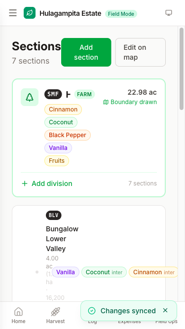
Mapping
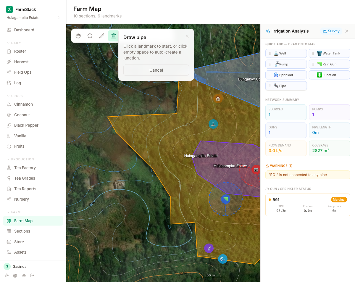
Map every inch of your land
Draw sections on a satellite map, plan irrigation, lay out pipe networks and place assets. Know exactly what's growing where, and how much of it.
- Satellite section mapping & areas
- Irrigation analysis & pipe layout
- Asset and crop placement